

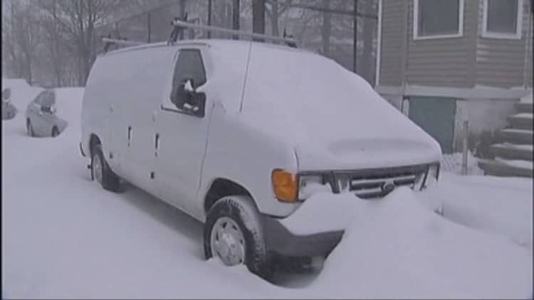
Tens of millions of people in the Northeast enjoying one of the warmest winters on record faced the ominous prospect of a massive and dangerous storm Monday that could blast the region with up to 18 inches of snow and winds capable of disrupting power, closing schools and creating travel chaos.
A powerful nor'easter was forecast to track along the East Coast late Monday through Tuesday, the National Weather Service said. Strong winds with gusts of up to 50 mph may cause blizzard conditions along some coastal areas.
The Weather Service warned that any change in track could dramatically alter the amount of snow and where it falls. But there is little doubt that a big storm will explode on the region, says Tom Kines, senior meteorologist for AccuWeather.
More from USA Today:
February record warm for 16 states, 145M Americans
'Winter's revenge': Record cold, snowstorms forecast in Midwest, East
'Winter is still around': Major storm targets Northeast
"A lot would really have to go wrong, so to speak, for this system to not deliver a ferocious punch," Kines told USA TODAY. "The reality is we are just hemming and hawing over snow amounts. Who gets 6, 12 or even 18."
Blockbuster snowstorms in March, while not common, aren't unprecedented. Two of the three largest and heaviest snowstorms in the Northeast since 1956 took place in March, according to The Weather Channel: in 1960 and 1993. The 1993 system, called the Storm of the Century, dropped crippling snow totals from Florida to Maine, left about 300 people dead and shut down travel for days.
A wet, heavy snow combined with high winds could mean damaged trees and powerlines and blocked roads this week. Washington, Baltimore, Philadelphia, New York and Boston all could face a direct hit, meaning airport disruptions could prompt flight delays and cancellations across much of the nation.
Philadelphia International Airport tweeted that some airlines would be issuing travel waivers and urged travelers to contact their carriers. With snow already rolling across parts of the Midwest, airlines canceled more than 100 flights Sunday and more than 500 on Monday, according to FlightAware. American, Delta and United were among carriers offering no-cost waivers for flights Tuesday and Wednesday at dozens of airports from Virginia to Canada if flights are rescheduled by Friday.
"Anybody looking to travel on Tuesday, whether by land or air, will find it difficult or impossible in many places," Kines warned.
Kines said two "pieces of energy" were involved. A storm system was dumping heavy snow across the Northern Plains on Sunday and was heading east. Another storm system will try to form Monday off the South Carolina coast, he said.
"That storm is going to take control," he said. "The big cities will probably fall into the 6- to 12-inch category. But there will be places that get 12 to 18. And it's not out of the question that New York or Boston will be among those places."
The National Weather Service issued a blizzard watch from New York City and Long Island to southern Connecticut, southern Rhode Island and parts of southeastern Massachusetts, including Boston. Parts of the Mid-Atlantic and Northeast, including Philadelphia, Baltimore and Washington were under winter storm watches.
Washington's transit system said it would shut down its paratransit program at 4 p.m. Monday and warned that bus service was imperiled. New York issued a snow alert and was preparing trucks for an assault on city streets. New York Gov. Andrew Cuomo promised state residents that his crews had more than 2,000 trucks and 443,000 tons of road salt at the ready.
"We are closely monitoring this storm as it develops, and I am directing all state agencies to be on alert and ready to respond as the weather develops," he said.
The menacing forecast comes less than two weeks after February wrapped up as the nation's second warmest since climate tracking became a thing in 1895. But days of bitter cold, with more to come, doesn't bode well for the confused flowers that had prematurely emerged on trees and plants across much of the region.
During the brunt of the storm, northeasterly winds will pull ocean water toward the coast and create rough surf from Virginia to Maine, Accuweather predicted, leading to tides 1-2 feet above normal. Coastal flooding and beach erosion are also a concern.
The storm was billed as a potential nor'easter — brutal storms that form along the East Coast as warm air from over the Atlantic Ocean clashes with arctic cold to the north and west. The storms get their name from the northeasterly winds that blow in from the ocean ahead of the storm.
Most of the region will be dealing with extremely cold temperatures until the weekend, so don't look for a quick melt, Kines said. The big storm, if it materializes, would hit just a week before spring officially arrives.
"The fact that it is snowing, that happens this late" in the season, Kines said. "When you start talking a foot of snow or more, that doesn't happen very often."