


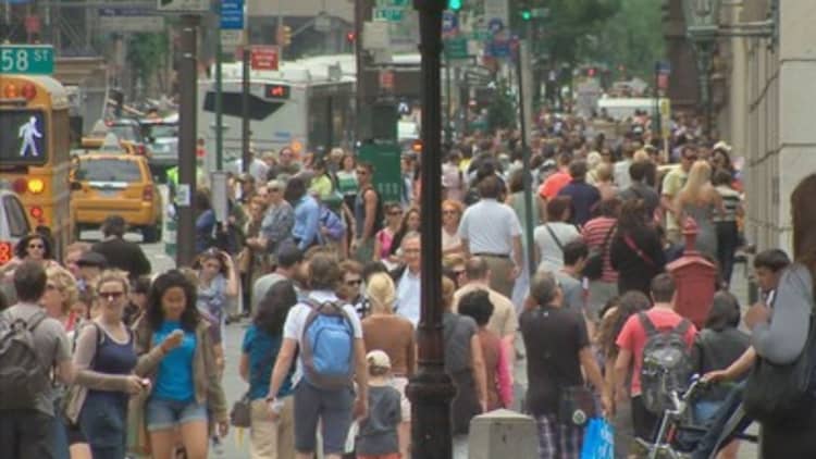
There may not be a white Christmas in New York City this year, and no, it's probably not because of El Nino.
The temperature in New York City was around 61 degrees on Thursday. Chicago temperatures were around 57 degrees. Boston was about 55 degrees.
Warmer weather in the Northeast is sometimes seen with a strong El Nino pattern, such as the one that's happening now. But at least one meteorologist said something else is more likely the reason the coats and gloves are gathering moths right now.
The warmth seen in the Northeast and such normally cold cities as Chicago is "really associated with the strengthened polar vortex," said Mike Halpert, deputy director of the Climate Prediction Center at the National Weather Service.
"I would not associate the lack of snow in Buffalo with El Nino," Halpert said on a call with reporters on Thurdsay. "It is much more likely the Arctic Oscillation."
"Arctic Oscillation" is a change in air pressure at the North Pole that affects how far south cold air travels from the Arctic.
First, it is important to understand a phenomenon called the polar vortex. The polar vortex is a ring of cold winds that swirls around the north pole (there is one at the South Pole, as well). Low pressure keeps those winds — and the cold air they carry — wrapped around the poles. At the furthest perimeter of this vortex is a jet stream of fast-moving, cold air.
But the pattern varies — high pressure in the Arctic can push the winds away from the pole and down to the the mid-latitude regions of the planet, where most people live.
Other times, the pressure at the Arctic can be so low that the vortex is especially tight, and a greater portion of cold air than normal is trapped near the pole.
Those fluctuations make up the Arctic Oscillation. When pressure at the Arctic is exceptionally high, the AO is "negative," when pressure is low, it is "positive."
The cold weather in the early months of 2014 was largely attributed to that shifting of the polar vortex away from the Arctic and toward the equator — a "negative" Arctic Oscillation. Over half of the United States was covered in snow, and some regions saw record cold temperatures.

Currently, the Arctic Oscillation is exceptionally positive, and the polar vortex has been stronger than average. The cold air that would otherwise chill the northern regions of the country is staying around the Arctic. So, regions that would normally be receiving snow at this time of year are unseasonably warm. Only a few mountainous regions in the country have seen snow.
Judah Cohen, a meteorologist with Atmospheric and Environmental Research, echoed Halpert's comments in a recent blog post.
A positive Arctic Oscillation pattern "has resulted in very mild temperatures across northern Europe, the Eastern United States and to a lesser degree East Asia," Cohen wrote.
However, he noted that the pattern is slowly transitioning, and "temperatures are likely to cool from their very elevated levels."
El Nino is almost certainly affecting weather and precipitation in the Northeast and elsewhere in the United States to some extent; much of the rain seen across the South is consistent with El Nino, for example.
But there are a few meteorological puzzles at work in the country right now. The rains drenching the Pacific Northwest are not typically associated with strong El Nino years, and the temperatures in Florida are puzzlingly high right now, given the all the rain that has been falling in parts of that state.
Halpert said the Climate Prediction Center projects that the strong El Nino — already one of the strongest ever recorded — will maintain its strength through the winter before gradually weakening in spring.
"For California, El Nino means that there is a pretty favorable tilt toward a wetter winter from January through March," Halpert said, but added that "this is not a guarantee" since climate is complicated and can be affected by many factors.
Predicting snow in the Northeast or Midwest is "trickier," he said, because strong El Ninos have accompanied both light and heavy snow in winter.
"So it is not something we can predict right now," he said.