

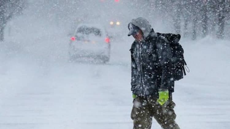
A large swath of the country from Texas to New York City was bracing for yet another round of winter weather on Thursday, with sleet and ice forecast for the Southwest and South, and up to a foot of snow in the Kentucky and southern Ohio.
The governors of Mississippi, Alabama, West Virginia and New Jersey all declared states of emergency ahead of the winter weather which started rolling through Wednesday night and is expected to last through Thursday. Around 100 million people in 28 states were under winter advisories.
Much of the South was forecast to see temperatures drop 30 to 45 degrees in a 24-hour period.
Read MorePictures of brutal US winter
West Virginia, Kentucky and southeastern Ohio were expected to get hit the hardest overnight into Thursday with 8 to 10 inches of snow, while Baltimore and Washington were looking at 6 to 8 inches, according to the National Weather Service.
More from NBCNews:
25-Vehicle Pileup Snarls Snowy Missouri Highway
This February Was the Coldest Month Ever in Northeast
Beware the Ice of March: More Frigid Records Are In Jeopardy
The good news is, once this winter storm heads off over the Atlantic, many Americans should finally get a break from the winter that seemed to never end.
"As far as large winter storms, this looks like the last one for a while," said Kevin Roth, senior meteorologist at The Weather Channel. "There are no guarantees that this will be the end of it, but it will be a nice break."
That prediction may be little comfort to travelers who planned to catch planes on Thursday. More than 2,000 flights scheduled for Thursday were cancelled, according to website FlightAware.
Read MoreHow small businesses can ride out winter's threats
Dallas-Fort Worth International Airport said about 300 departures scheduled to depart Wednesday — about 30 percent of outgoing flights — were cancelled, and about 175 flights scheduled for Thursday were scrubbed ahead of freezing rain and sleet which started to hit Wednesday night.
More than 200 departures out of Philadelphia International Airport scheduled for Thursday were cancelled as the region braced for between 4 and 8 inches of snow. Reagan National Airport in Arlington, Virginia; Newark Liberty Airport in New Jersey; and LaGuardia Airport in New York City also had large numbers of departures scheduled for Thursday cancelled, according to FlightAware.
Sleet is expected from northeast Texas to northwest Tennessee — metro Nashville public schools were closed preemptively — and icy conditions are forecast for northern Louisiana, eastern Arkansas, parts of Mississippi and northern Alabama. Parts of Kentucky and southern Ohio could get 8 to 12 inches of snow, Roth said. New York City emergency management officials warned that 8 inches could fall on the city and officials in Washington cancelled school.
Bitterly cold temperatures are also forecast. Chicago is expected to be 1 degree Thursday morning; Lexington, Kentucky could see 0-degree temperatures; and residents of Columbus, Ohio, can expect temperatures of around 3 degrees.
Roth said warm ocean temperatures kept an area of high pressure stuck over the West for much of this winter, sending the jet stream and Arctic air plunging southwards and over the East and South and causing sustained winter woes.
"We were locked into a pattern. The same areas were hit repeatedly," he said. "The pattern didn't change. Usually we can get some fluctuation," that helps break up the cold weather and snow, Roth said. But that has also meant less precipitation in the West, resulting in less snow in the mountains and providing little help for drought-stricken California.
--The Associated Press contributed to this report.