

An earthquake measuring 6.8 struck northwest of Imphal, the capital of India's Manipur state, near the Myanmar border, before dawn on Monday, the U.S. Geological Survey said.
The USGS said the quake was 57 kilometers (35 miles) deep, and initially reported that it had struck inside Myanmar. Manipur is also close to India's border with Bangladesh. Associated Press (AP) reported that the Indian Meteorological Department had put the earthquake at a much shallower depth of 17 kilometers (10 miles).
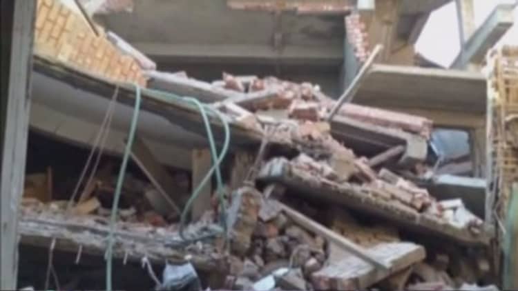
At least four people were killed and as many as 100 injured, with the toll expected to rise, after residents fled their homes and power to the city was knocked out. Telecommunications links were also down.
According to Reuters, police and disaster response teams in Imphal, which has a population of about 270,000, reported that parts of walls, staircases and roofs on buildings had collapsed. The city's hospital was among the buildings hit.
AP reported that the quake caused people to rush from their homes in Gauhati, the capital of neighboring Assam state, while the BBC reported that people were seen fleeing their homes as far away as Bangladesh, and Reuters said that residents in Nepal also felt the quake, as did those in the Myanmar capital Yangon, which is about 1,176 kiometers (730 miles) from Imphal.
An official at Myanmar's Meteorological Department in Naypyidaw told Reuters were no reports of damage or casualties on the Myanmar side of the border.
The area has a history of earthquakes due to movements in the Indian and Eurasian tectonic plates below the Earth's surface.