


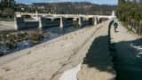
A series of storms are expected to hit California this weekend, but the anticipated rain is not likely to bring the state anywhere near back to normal. Since Oct. 1, the traditional start of the "water year," Los Angeles has received 5 inches of rain. That is one-third of the average, or at least the average before the epic four-year drought began.
"Dónde está El Nino?" asked Josh Willis, a NASA climate scientist at JPL. He's not the only one. Last summer, Willis' colleague predicted the forming weather pattern would be "The Godzilla of El Ninos," one that was "too big to fail."
For a while, that prediction looked like a good one. Storms hit California in January, sending the snowpack 115 percent above normal.
Then the rain stopped, and February was the hottest on record. The snowpack is now down to 83 percent of average.
Once again, weather forecasters got it wrong. After decades of collecting data, why is it still so hard to predict the weather? "Yogi Berra said, 'Predictions are hard to make, especially about the future,'" joked Willis.
In truth, he said it's especially hard to predict El Ninos, because the unusual weather pattern only rolls around once every 10 or 15 years. "We've really only seen two big El Ninos since we've had our big observing systems that look really hard at what it does," he said. "That means we've only had two chances to get it wrong, and we need a few more before we start getting it right."
Willis said each El Nino is different, and this year's has been "a whopper" globally, just not in California. Why? "The warm waters actually spread really far north of the equator to about the center of Mexico." He believes this could still mean rain for California in the spring. "It might have actually been that this El Nino was so large in size that it pushed our rain farther north into Oregon and Washington, and as it shrinks and faces away, we could get some of that rain back."
Or not. Who knows? Predicting the weather seems harder than predicting the stock market. "The stock market runs away when you try to predict it," said Willis. "The weather is just pretty random."
The climate scientist admitted all of his friends are demanding he refund the money they spent on galoshes. "Don't put those galoshes in deep storage yet," Willis said. "We could still get some rain in March and April."
Stay tuned.