


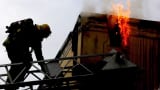
Three years after a deadly bombing at the Boston Marathon, technology has changed the way law enforcement and first responders monitor the event.
Monday will mark the third year that Massachusetts authorities have used a high-tech partner, Esri, to do real-time tracking of the race, a method that makes the most crucial aspect of crisis management — communication — quicker and more efficient.

Here's how it works: A map of all 26.2 miles of the event shows real-time movement of runners, live traffic and weather, the number of patients in medical tents, and even things like emergency vehicles and helicopter landing pads. An estimated 200 people are logged in at any given time, broadcasting the statistics to groups of people from federal authorities in Washington to local law enforcement.
When anything happens, from a cell tower getting overloaded to a suspicious package appearing, someone on the ground calls a liaison at the command center to flag it on the map.
Boston Marathon Dashboard, courtesy the Massachusetts Emergency Management Agency.
Command-and-control platforms are key when every second counts, said Michael O'Neil, CEO of MSA Security, who isn't involved in the Boston Marathon, but has made security plans for other high-risk events.
"If there was a security event at mile 5, you want to communicate to checkpoints at the remaining miles," said O'Neil, who was the first commanding officer of the counterterrorism unit of the NYPD after 9/11. "That's where a command-and-control apparatus comes into play. Lock down areas, stop secondary and tertiary attacks — that's what law enforcement will think of."
This technology has advanced as attacks, like those in Boston, catalyzed more security needs among event planners, said Desiree Kocis, GIS Coordinator at the Massachusetts Emergency Management Agency.
"[In the past] technology has always forced us to compromise what we can do from an information sharing perspective," said Christopher McIntosh, director of public safety industries at Esri. "But that's no longer the case. The hard part is for the people to understand what's possible, what they should share with each other, and that's what's taking time."
This is especially true for marathons, which don't have a closed perimeter and span large distances, O'Neil said. For those kinds of events, new technology like drones can cover a wider spectrum of security challenges than people alone, said Arnette Heintze, co-founder and CEO of Hillard Heintze, an investigation and security risk management company.
"When you look [at] security, there's three legs to the stool: people, process and technology," Heintze said. "When you have large crowds gather, you need people to guide, direct, inform. Process, would involve ... credentials, levels of access to event sites. That's a process that needs to be mapped out by technology and people to make sure it works."
Other companies, like Microsoft and Motorola Solutions have also explored public safety solutions as terror attacks, like those in Paris, Brussels and San Bernardino, California, have rekindled popular awareness.
"We saw the potential because it's critical for us to make decisions much faster than we were before," said Kocis. "It makes people feel more comfortable."