


The strongest hurricane to hit Haiti since 1964 is making its way north toward Florida.
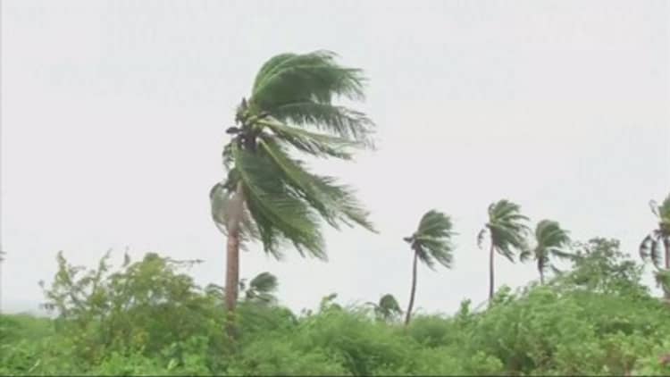
Hurricane Matthew made landfall in Haiti at around 7 a.m. ET Tuesday. Hurricane warnings are still in effect for Haiti, several Cuban provinces, and the Bahamas. With winds measured at 145 miles per hour, it is the first Category 4 hurricane to hit Haiti since Hurricane Cleo in 1964.
Most global forecast models suggest Matthew will be churning off the east coast of Florida and the southeast United States by Friday morning, according to a National Hurricane Center update Tuesday.
On Tuesday, Florida Governor Rick Scott tweeted that evacuation orders may begin soon, telling Floridians to keep eyes on local news.
The governor has already issued a state of emergency, and hurricane watches have been issued in south and central Florida, including the Keys. "If Hurricane Matthew directly impacts Florida," said Governor Scott in a statement, "there could be massive destruction, which we haven't seen since Hurricane Andrew devastated Miami-Dade County in 1992."
South Carolina Governor Nikki Haley also plans to evacuate 1 million people from the coast on Wednesday afternoon, according to the Associated Press.
Winds along the western edge of a subtropical ridge of high pressure are pushing the storm north, and it is expected to run parallel to Florida's coast, the NHC noted.
Though the center of the hurricane is still forecast to sit out in the ocean, National Weather Service offices are warning that effects could spread to the shore.
People reading the forecast "are reminded not to focus on the exact forecast track since strong winds, heavy rainfall, and a dangerous storm surge will extend far from the center of Matthew," said the National Hurricane Center update.
The local NWS office in Melbourne, Florida, issued a notice saying that the threat from Matthew to east central Florida "is serious and had increased," with forecasts of "large breaking waves" over 12 feet tall, and the potential for 3 to 6 inches of rain from Thursday to Friday. That could lead to flooding or "ponding," since the area is already saturated from recent rains.
The NWS Miami office also warned in a notice of winds possibly strong enough to damage buildings and snap or uproot trees, along with the potential for power outages.
Florida had been all but free of hurricanes for more than a decade, until the category 1 Hurricane Hermine made landfall in early September.
Hurricane Matthew will be the strongest hurricane, and the only category 4, to hit Florida since Hurricane Charley in 2004.